
Where to Buy a House in Palo Alto, CA: Neighborhoods and Market Trends
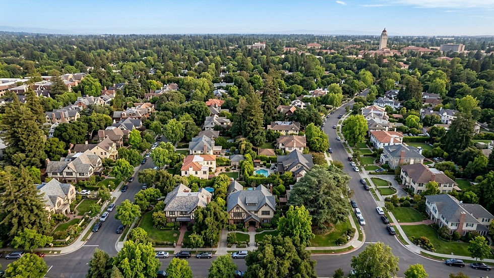
Anyone buying a home in Palo Alto, CA will find a city that sits at the center of Silicon Valley, up against Stanford University, with a housing stock that ranges from historic estates to mid-century modern subdivisions to newer attached homes. The market moves fast and it does not apologize for its prices. As of mid-2026, the median sale price is roughly $3.61 million, and the typical home goes under contract in about 14 days.
If you're trying to figure out which neighborhood actually fits what you need, simple geography won't get you there. You have to think about housing styles, lot sizes, and how close you want to be to your commute route. Some blocks have mature tree canopies and binding historic preservation rules. Others have a semi-rural feel - no sidewalks, no streetlights. The right location comes down to your budget and the type of property you want to own.
How Palo Alto, CA Is Organized
The city stretches from the San Francisco Bay up into the foothills of the Santa Clara County mountains. Most of the residential housing falls between Highway 101 to the east and Interstate 280 to the west, which makes commute access a real factor for anyone working at local tech campuses.
Palo Alto has more than two dozen recognized neighborhoods, each with its own architectural character and zoning rules. Agents and listing services tend to group them into broader north, south, and west sectors, but if you're searching listings, you'll see specific subdivision names - and those names matter for pricing and deed restrictions.
Recognized Neighborhoods and Subdivisions
The recognized neighborhoods include Downtown North, Professorville, University South, Crescent Park, Community Center, Duveneck/St. Francis, Leland Manor/Garland, Old Palo Alto, Southgate, College Terrace, Evergreen Park, Midtown/Midtown West, Palo Verde, Fairmeadow, Charleston Meadows, Greenmeadow, Ventura, Barron Park, Green Acres, Palo Alto Hills, University Park, Charleston Terrace, Research Park, and Oak Creek. Median prices across those areas range from about $1.1 million in Green Acres up to $9.1 million for certain properties in Old Palo Alto - so the spread is not small.
Mapping Out the Neighborhoods
Knowing where these communities sit relative to landmarks makes a property search more efficient. The Stanford University campus borders several neighborhoods on the western edge of the city, and the local multiple listing service (MLS) designates a specific "Stanford" area for homes nearby. On the eastern side, the Palo Alto Baylands Nature Preserve runs along the waterfront, and Esther Clark Park offers trails closer to the southern tracts.
A neighborhood map also shows how commercial centers anchor different residential zones. The Midtown Shopping Center serves the central neighborhoods. University Avenue and California Avenue anchor the northern and western sections.
Using Interactive Boundary Maps
When you're searching for homes, rely on interactive boundary maps rather than general descriptions - especially for school attendance zones. The Palo Alto Unified School District (PAUSD) operates out of its headquarters at 25 Churchill Avenue, but which elementary, middle, or high school a home is zoned for depends on the precise street address. The district maintains official interactive maps for exactly this purpose. Use them.
Home Types and Typical Prices
Recent 2026 data shows homes selling for about 6% above list price on average, and with roughly 71 homes in active inventory in a given month, you're not working with a lot of options. Detached single-family homes dominate the market, though townhomes and condominiums exist closer to the commercial downtown districts. Pricing swings hard depending on neighborhood and home style.
Historic Homes and Estates
The oldest, largest homes carry the highest price tags. Crescent Park, northwest of Midtown, has a population of 7,682 according to a Niche report, and the median home price there reached roughly $5.93 million in early 2025. Old Palo Alto is in the same range, with a median of $5.6 million. Professorville is its own category - a federally designated historic district listed on the National Register of Historic Places, comprising early faculty housing bounded roughly by Embarcadero Road, Addison Avenue, Emerson Street, and Cowper Street.
Mid-Century and Eichler Designs
Move south and the architecture shifts. Greenmeadow, Green Gables, and Charleston Meadows are known for one-story Eichler-style homes - open floor plans, floor-to-ceiling windows, radiant heating. Green Gables sits near Old Palo Alto and Crescent Park and carries its own architectural restrictions to keep the mid-century character intact.
Unique Streetscapes and Rural Feels
Not every Palo Alto street follows a standard suburban grid. Barron Park has an intentionally rural feel - lots of trees, and streets that frequently lack curbs or sidewalks. That's a real departure from Downtown North, where the streetscapes are manicured and single-family homes carry a median of about $2.85 million. Midtown lands in the middle in more ways than one: centrally located, anchored by the Midtown Shopping Center, with a median home price of roughly $3.27 million.
Local Housing Market and Living Costs
The median sale price is around $3.61 million, and you should go in expecting competition. Roughly 68 homes sold in a recent 30-day period, which represents about one month of supply. That's a thin market.
Beyond the purchase price, build in property taxes, insurance, and local utility costs. NeighborhoodScout puts the city's population at about 67,658 residents spread across 26,054 housing units - a dense, established residential environment with very little churn.
Researching Local Crime Data
For crime data, go directly to official sources. The Palo Alto Police Department and the Santa Clara County Sheriff both provide access to crime mapping tools and public records. The FBI Uniform Crime Reporting (UCR) program publishes city-level data if you want to compare Palo Alto to other parts of Santa Clara County.
Finding Your Palo Alto Home
Fourteen days on market means you cannot afford to be slow. Have your financing sorted before you start touring - cash offers are common here, and if you're using a mortgage, full underwriting approval in advance is the floor, not a bonus. Working with an agent who knows the hyper-local pricing differences will save you from mispricing your offers. The gap between a $3.27 million Midtown home and a $5.93 million Crescent Park property is not random - it reflects subdivision-level demand, lot size, and architectural character that comparable sales make legible.
Renting Before Buying
Given how thin the inventory is, some buyers rent in Palo Alto while they wait for the right property. It's a reasonable strategy. Renting gives you time to test different commute routes to Stanford or local tech campuses, and it lets you actually experience the difference between the historic northern neighborhoods and the Eichler-heavy southern tracts before you commit to a multi-million-dollar purchase.
Frequently Asked Questions
What is the most affordable neighborhood to buy a house in Palo Alto?
Green Acres generally offers the lowest entry point for single-family homes in the city, with median prices starting around $1.1 million - well below the citywide median of $3.61 million. Condominiums and townhomes in commercial areas may also come in below detached housing prices.
Which Palo Alto neighborhoods are zoned for Gunn High School versus Palo Alto High?
School assignments depend on your exact street address, not the broader neighborhood name. The Palo Alto Unified School District (PAUSD) uses specific attendance boundaries for its high schools. Check the official PAUSD interactive boundary maps to confirm zoning for any individual property before you make an offer.
Where should I live in Palo Alto if I want a walkable neighborhood near University Avenue?
Downtown North and University South are the closest residential areas to the University Avenue commercial district. Downtown North has a median home price of about $2.85 million. Both areas put you within easy reach of the shops, restaurants, and transit options along that corridor.
Which Palo Alto neighborhoods are best for commuting to Stanford or local tech campuses?
College Terrace, Evergreen Park, and Southgate sit immediately adjacent to the Stanford University campus. For broader Silicon Valley commutes, neighborhoods on the eastern edge like Crescent Park give you quicker access to Highway 101, while western neighborhoods like Palo Alto Hills sit closer to Interstate 280.
How does living in Crescent Park compare to Eichler-heavy neighborhoods like Greenmeadow?
Crescent Park has larger, historic homes, mature tree canopies, and a median price of $5.93 million. Greenmeadow and the nearby Green Gables area are built around one-story, mid-century modern Eichler homes. The architectural styles and lot layouts are entirely different between the two.
Are there specific Palo Alto neighborhoods with strict historic preservation rules or building restrictions?
Yes. Professorville is a federally designated historic district listed on the National Register of Historic Places and included in the City of Palo Alto's local Historic Inventory. Properties within its boundaries - roughly between Embarcadero Road, Addison Avenue, Emerson Street, and Cowper Street - are subject to specific preservation guidelines.


Comments