
Where Is Los Altos, CA? Boundaries, Commutes, and Where to Buy

Los Altos is a city in Santa Clara County, California, sitting on the Peninsula side of Silicon Valley, roughly midway between San Francisco and San Jose.
Key takeaway
Los Altos is its own city in northwest Santa Clara County. It borders Palo Alto, Mountain View, Sunnyvale, Cupertino, and the separate town of Los Altos Hills. Houses sell quickly and well above list price, so if you want the address for less and with room to negotiate, look at condos.
Who this guide is for
You're considering a move to the Peninsula and need to know where Los Altos sits, how far it is from work, and which part of town to search before you open listings.
City boundaries and layout
The city covers 6.54 square miles of land. Its borders are irregular, so a Los Altos mailing address doesn't guarantee a property falls within city limits.
Cities that border Los Altos
Palo Alto borders the city to the north, Mountain View and Sunnyvale to the east, and Cupertino to the south. To the west, the city meets the sphere of influence of the Town of Los Altos Hills. Look up the parcel with the Santa Clara County Assessor before assuming which city's rules apply.
Highways and roads through Los Altos
Interstate 280 is the only freeway with an access point in Los Altos, at Exit 13 for Foothill Expressway and Grant Road. Foothill Expressway runs parallel to I-280 through the city, on the old Southern Pacific rail line the town grew up around. El Camino Real runs through the area as a regional arterial. With no freeway through the middle of town, most trips start on one of those two roads.
Commuting to San Francisco and San Jose
Drive times to San Francisco, San Jose, and nearby job centers
Driving from downtown Los Altos to San Francisco, downtown San Jose, or the Palo Alto and Mountain View job corridors starts on local roads before you reach I-280 or US-101. The time depends on whether you travel with or against peak traffic. Treat any published time as a minimum, and drive your own route on a weekday morning before you make an offer.
Caltrain, buses, and airports
Los Altos has no Caltrain station of its own. VTA Line 40 links downtown to the San Antonio and Mountain View Caltrain stations, lines 22 and 522 run along El Camino Real, and line 51 serves the southern part of town. Reaching the train usually means driving, biking, or a bus transfer, so check parking and bike access at the station you'd use.
Is Los Altos the same as Los Altos Hills?
Los Altos Hills is a separate town with its own government, incorporated on January 27, 1956. Its zoning requires a minimum lot size of one acre.
The confusion usually comes from the mail. The 94022 and 94024 ZIP codes are shared across the City of Los Altos, the Town of Los Altos Hills, and adjoining unincorporated areas such as the Loyola community. Permits and local rules follow the parcel, not the ZIP code, so use the assessor lookup above.
Los Altos neighborhoods by location
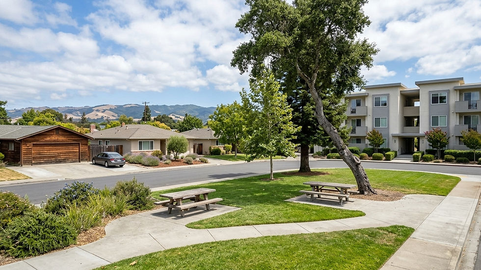
The City of Los Altos has never officially defined neighborhood boundaries, but commonly recognized areas include Old Los Altos, Central Los Altos, North Los Altos, Loyola Corners, South Los Altos, and Country Club. The first three sit closer to downtown and El Camino Real. The rest lie toward Foothill Expressway, I-280 and the hills. Citywide, a condo costs about a third of the median house price.
Old Los Altos
Old Los Altos surrounds downtown, so you can walk to shops and restaurants without a car for every errand. In exchange, you get weekend and evening activity and parking pressure. Walk the block on a Saturday, and check older homes' permit history with the City of Los Altos building department.
Central Los Altos
Central Los Altos sits between downtown and the main cross-town roads, keeping the downtown shops and Foothill Expressway a short drive away. Some streets serve as cut-throughs between Foothill Expressway and San Antonio Road, so check traffic on the specific street at commute hours.
North Los Altos
North Los Altos is the side of town nearest El Camino Real and the Mountain View and Palo Alto Caltrain stations. Homes near El Camino Real can pick up traffic noise, so visit at rush hour.
Loyola Corners
Loyola Corners centers on a small shopping node along Foothill Expressway, away from downtown. Part of the Loyola area carries a Los Altos address but sits in unincorporated Santa Clara County, which changes who handles permits and services.
South Los Altos
South Los Altos lies toward Cupertino and I-280. Downtown is a drive from most of it, so errands mean the car or the Loyola Corners shops.
Country Club
Named for the nearby Los Altos Golf & Country Club, this area sits near the Los Altos Hills edge. Club membership is private and separate from living here. Near the town line, confirm the parcel is in Los Altos, not Los Altos Hills.
How to narrow down where to look in Los Altos
Yvonne Yang Homes can help you check an address's jurisdiction and drive the commute routes with you to verify travel times.
If you'll commute by Caltrain, start with North Los Altos and read the Caltrain section. If you'll commute by freeway, start with South Los Altos and Country Club and read the highways section. If you want to walk to downtown shops and restaurants, start with Old Los Altos and Central Los Altos. If your budget is closer to the condo median, shop condos first: fewer than 1 in 5 recently sold above asking, so you have room to negotiate. If you want an acre or more of land, read the Los Altos Hills section first, because that minimum is the neighboring town's rule, not Los Altos's.
Related guides: Los Altos Population.
At a glance
Median sale price, all homes: $4,617,801, up 12% year over year (90 days ending 2026-09-30, 76 sales)
Median sale price, single family: $4,906,044, up 7% year over year (90 days ending 2026-09-30, 60 sales)
Median sale price, condo: $1,549,841, down 46.5% year over year (90 days ending 2026-09-30). Based on only 12 condo sales, so the drop likely reflects which units sold rather than a true value trend.
Median days on market: single family 8, condo 69 (12 sales), all homes 9 (90 days ending 2026-09-30)
Sale-to-list ratio: single family 108%, condo 98% (12 sales), all homes 106.3% (90 days ending 2026-09-30)
Share sold above list price: single family 69.5%, condo 16.6% (12 sales), all homes 60% (90 days ending 2026-09-30)
Months of supply: single family 1.3, condo 3.1 (12 sales), all homes 1.6 (90 days ending 2026-09-30)
Homes for sale (inventory): single family 25, condo 13, all homes 39 (90 days ending 2026-09-30)
Median price per square foot: single family $2,152, condo $1,155 (12 sales), all homes $1,970 (90 days ending 2026-09-30)
Los Altos, CA location FAQs
Is Los Altos its own city, or part of Palo Alto?
Los Altos is a separate incorporated city with its own council and police department, not part of Palo Alto. It incorporated as a general law city on December 1, 1952.
How much is sales tax in Los Altos, CA?
The combined sales and use tax rate is 9.750%, effective April 1 through June 30, 2026, and unchanged into the current quarter.
How much property tax would I pay on a $1 million home in Los Altos?
California limits the base rate to 1% of assessed value, plus voter-approved bond debt that varies by tax rate area. At a 1.2% total rate, a home assessed at $1,000,000 would owe $12,000 a year, plus any flat parcel taxes.
What ZIP codes does Los Altos, CA use?
Los Altos uses 94022 and 94024. It shares both with the Town of Los Altos Hills and with unincorporated land such as the Loyola community, so the ZIP code alone doesn't tell you the jurisdiction.
What school district is Los Altos in?
Two separate districts serve the city: the Los Altos School District (LASD) for grades K-8 and the Mountain View-Los Altos Union High School District (MVLA) for grades 9-12. Their assignments don't always align, so check an address with each district's boundary lookup.
Why is Los Altos called Los Altos?
"Los Altos" is Spanish for "the heights." The company that planned the new town chose the name because the land was the highest on that railway cutoff.
Is Los Altos safe?
The Los Altos Police Department publishes a five-year crime comparison table on the city's website. Residential burglaries were 62 in 2024 and 43 in 2025, with one homicide in 2025. Look at the multi-year trend rather than a single year.


Comments